By Vicki Brown
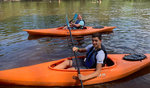
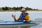
Everyone seems to be looking for something new to do in our more relaxed post-Covid world, so why not plan a Kayaking trip?
Following the Edisto River Canoe and Kayaking trail is the perfect summer vacation. There are activities and campgrounds all along the trail, easily accessed for kayak enthusiasts.
Downloadable maps and information can be found at www.ERCKTrail.org.
A waterproof printed map is available for purchase via the website. Map sale proceeds will benefit the ERCK Trail Commission.
The project is a joint partnership between Colleton County, Dorchester County, and the South Carolina National Heritage Corridor (SCNHC) in an effort to promote one of South Carolina’s most unique natural habitats.
The ERCK trail covers a 62-mile stretch of the Edisto River, the longest free-flowing blackwater river that covers 250 miles in the United States and one of the longest worldwide.
The ERCK Trail Commission was established by Colleton County in 1989 by Charlie Sweat who lived a lifetime of public service, serving 27 years on Walterboro City Council and one term as mayor. Sadly, he passed away this past January.
Sweat’s contribution in bringing awareness to the beauty and diversity found on the Edisto River has created wonderful opportunities for nature lovers and those who enjoy quiet canoe and kayak trips.
Simply pack the kayak hull with tents, cookware, edibles and fishing equipment, then be on your way.
Here are entry points and places to camp along the way.
Green Pond Church Landing to Simmons Landing (3 miles).
The uppermost stretch of the ERCK Trail begins at Green Pond Church Landing and continues to Simmon’s Landing. This stretch of river is very narrow with swifter currents and impassable for canoes and kayaks during drought and if water levels are below 3’ on the Givhans Gauge. Please note that Simmons Landing is a private, fee-based access point.
Simmons Landing to T. Coke Weeks Landing (6 miles).
This section is where the river begins to widen, though tighter hairpin turns exist along the entire ERCK Trail. Paddlers cross under Interstate I-95 approximately 2 miles down river. Fossils have been found there lying on the river banks and bed. A South Carolina Hobby License is required in order to remove submerged fossils from the river and rules and regulations apply. For the last mile of the route, paddlers will pass the closed SCE&G’s Canadys Station Power Plant.
Colleton State Park is located directly across the river from Weeks Landing on river right.
Colleton State Park offers easy access to the river, a .3-mile interpretive trail, campground, picnic shelter, and biking.
T. Coke Weeks Landing to Minnie Gruber Rumph Landing (9 miles)
This stretch is perfectly suited for a long, lazy day of paddling and fishing. Boat ramps at each access and a steady stream of river cabins make it a popular fishing destination for john boats. According to experienced kayakers, about 3.5 miles in, the river splits briefly into two channels with the river right passage picking up a considerable amount of velocity. Be wary of being pushed into the river bank here. The takeout is located just before the bridge on river right.
Minnie Gruber Rumph Landing to Mars Oldfield Landing (8 miles).
At normal to lower water levels, there is a small “rock” island in the middle of the river channel less than a mile after putting in. Stagecoaches used this feature to ford the river during lower water levels. The takeout is on the right with a long concrete ramp.
Mars Oldfield Landing to Givhans Ferry State Park (6.5 Miles).
During the last mile of this section, large bluffs on the left forces the river to make a ninety degree turn from east to south. Givhans Ferry State Park is located high on these bluffs. For those with energy to paddle upstream, 4 miles along this route Four Holes Swamp provides a side trip. Tubers float this stretch of the river.
Right on the shores of the Edisto and not too far from the Mars Oldfield put in, you’ll find Bee City, which offers an up-close view of a working hive, honey available for purchase, and even a petting zoo that is home to wallabies, lemurs, alpacas, rabbits, monkeys and goats. A Nature Center features snakes, lizards, turtles, frogs, and alligators. It’s a great place to spend a few hours, enjoy animals, and grab a snack.
Givhans Ferry State Park to Messervy Landing (3 Miles).
This part of the ERCK Trail is wider and straighter. After only paddling one-fourth-of-a-mile, river-goers pass under the Highway 61 Bridge. Due to its proximity to Givhans Ferry State Park’s full-service facilities, this is one of the most highly used parts of the ERCK Trail. It is well known for being the primary tuber/floater and boat/jet ski route during the summer months.
Givhans Ferry State Park offers kayak and canoeing, a hiking trail, fishing, camping, swimming, biking, picnic shelter, and more. Between these two landings is Edisto River Adventures which offers riverside tent camping.
Messervy Landing to Good Hope Landing (4 Miles).
Several abandoned river channels and developing oxbow lakes are on this route. From Messervy Landing downstream, fishermen in small motorboats become more prevalent.
Good Hope Landing to Long Creek Landing (4 Miles).
This stretch of the ERCK Trail is a “sister section” to the one immediately upstream. According to ERCK Commission members, the takeout at Long Creek landing is not on the main channel of the Edisto. It is accessed by paddling 0.2 miles up the side draw on river right, just after one passes the second set of river homes on river left.
Long Creek Landing to Sullivan’s Ferry landing (2 Miles).
The primary landmark along this stretch is the Highway 17A Bridge, which is about ¾ of a mile after the Long Creek Landing.
Sullivan’s Ferry Landing to Lowndes Landing (5.5 Miles).
Roughly 3 miles in on river’s left, Parkers Ferry Road runs along the river’s edge. Sand bars are prevalent along this stretch when the Givhans Gauge reads under 3.2 feet. This offers secluded camping options along the ERCK Trail.
Lowndes Landing marks the lower boundary of the official ERCK Trial, though Martin’s Landing is the next public access site and is located in Charleston County about 2.5 miles downstream.
Fishing on the Edisto
A total of 87 freshwater species and 120 saltwater species of fish have been identified in the Edisto. Largemouth bass, striped bass, catfish and black crappie, but the prized red breast may be the most sought after species along the ERCK Trail.
If planning a multi-day adventure on the ERCK Trail, riverside accommodations on this stretch include cabins and camping at Colleton and Givhans Ferry State Parks. Edisto River Adventures Just upstream of the ERCK Trail are the revered treehouses owned and managed by Carolina Heritage Outfitters.
Carolina Heritage Outfitters Treehouses are pricey, but contain three rustic and secluded treehouses, located within the private 150-acre Edisto River Refuge, sleep up to four, six or eight people and are available March 1st through the end of November. The treehouses are situated out of sight of each other around the edges of a quiet river peninsula, bordered by a creek at the neck creating almost an island. There is no electricity or running water. Outhouse facilities are located near each unit.
Each treehouse features:
A small kitchen area with a table and chairs, propane stove, pots and pans, plates and utensils
A dining deck with an outdoor gas grill
A screened sleeping loft with one or two futon mattresses depending on the size of the unit
Futons on the main level that fold out to accommodate an additional sleeping area
Rechargeable lanterns
A swinging rope hammock
A few games such as dominoes and playing cards
Visitors pack and transport their own food supplies for all meals. Other items to bring include sleeping bags, pillowcases, and towels. Carolina Heritage Outfitters provides a list of other suggested items to pack for your adventure.